Kings Mountain: Difference between revisions
m (→Notes) |
|||
| (3 intermediate revisions by the same user not shown) | |||
| Line 42: | Line 42: | ||
Bearing: 50° |
Bearing: 50° |
||
| + | |||
| + | === K6MPN-Kings-Mntn-hAP-01 === |
||
| + | Radio: Mikrotik hAP |
||
| + | |||
| + | Antenna: Build-in |
||
| + | |||
| + | Frequency: 2397 MHz / Channel -2 |
||
| + | |||
| + | Bandwidth: 10 MHz |
||
| + | |||
| + | Location: 37.4360027 -122.3202621 |
||
| + | |||
| + | Altitude: - |
||
| + | |||
| + | Bearing: - |
||
== Contacts == |
== Contacts == |
||
| + | === Site Admin === |
||
| + | |||
| + | * Unknown |
||
| + | |||
| + | === Mesh Admin === |
||
* Rachel Kinoshita - KK6AC - kk6dac@gmail.com |
* Rachel Kinoshita - KK6AC - kk6dac@gmail.com |
||
Latest revision as of 21:39, 6 March 2023
South County Amateur Radio Emergency Services (K6MPN)
Site is located in the Woodside hills (map)(photos)
Site Details
Configuration
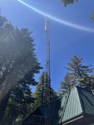
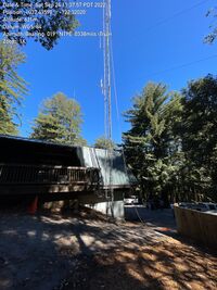
Kings Mountain hosts two 120° sectors + Rocket M5 radios. There is also a camera. Everything is mounted on a 60ft tower.
Notes
The site is surrounded by tree on all sides. However, from the top of the tower there is a 90 degree gap looking north east which allows antennas to "see out".
Nodes
K6MPN-Kings-Mntn-North
Radio: Rocket M5
Antenna: 120° sector
Frequency: 5895 MHz / Channel 179
Bandwidth: 10 MHz
Location: 37.4360027 -122.3202621
Altitude: 690m
Bearing: 50°
K6MPN-Kings-Mntn-South
Radio: Rocket M5
Antenna: 120° sector
Frequency: 5875 MHz / Channel 175
Bandwidth: 10 MHz
Location: 37.4360027 -122.3202621
Altitude: 690m
Bearing: 50°
K6MPN-Kings-Mntn-hAP-01
Radio: Mikrotik hAP
Antenna: Build-in
Frequency: 2397 MHz / Channel -2
Bandwidth: 10 MHz
Location: 37.4360027 -122.3202621
Altitude: -
Bearing: -
Contacts
Site Admin
- Unknown
Mesh Admin
- Rachel Kinoshita - KK6AC - kk6dac@gmail.com

