Kings Mountain: Difference between revisions
Jump to navigation
Jump to search
(→Nodes) |
No edit summary |
||
| Line 1: | Line 1: | ||
| − | [[South County Amateur Radio Emergency Services (SCARES)|South County Amateur Radio Emergency Services (K6MPN) |
+ | [[File:KingMountainFS1.jpg|thumb]][[South County Amateur Radio Emergency Services (SCARES)|South County Amateur Radio Emergency Services (K6MPN)]] |
Site is located in the Woodside hills ([https://www.google.com/maps/@37.43593,-122.322254,17z map])([[King Mountain Photos|photos]]) |
Site is located in the Woodside hills ([https://www.google.com/maps/@37.43593,-122.322254,17z map])([[King Mountain Photos|photos]]) |
||
Revision as of 21:47, 26 September 2022
South County Amateur Radio Emergency Services (K6MPN)
Site is located in the Woodside hills (map)(photos)
Site Details
Configuration
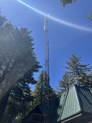
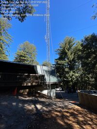
Kings Mountain hosts two 120° sectors + Rocket M5 radios. There is also a camera. Everything is mounted on a 60ft tower.
Plans
None
Nodes
K6MPN-Kings-Mntn-North
Radio: Rocket M5
Antenna: 120° sector
Frequency: 5895 MHz / Channel 179
Bandwidth: 10 MHz
Location: 37.4360027 -122.3202621
Altitude:
Bearing:
K6MPN-Kings-Mntn-South
Radio: Rocket M5
Antenna: 120° sector
Frequency: 5875 MHz / Channel 175
Bandwidth: 10 MHz
Location: 37.4360027 -122.3202621
Altitude:
Bearing:
Contacts
- Rachel Kinoshita - KK6AC - kk6dac@gmail.com

